
This blog is for discussion of Mineral King, Sequoia National Park and related issues. Click on the "xx comments" word below to go to the blog and/or post a new message.
Along the trail to Aspen Flat
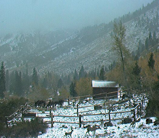
Mineral King Valley, 7830 ft elevation, October 5, 2007 AM
479 comments:
1 – 200 of 479 Newer› Newest»Hi Pops,
I was in MK this last weekend as well. I hiked up to the Eagle sinkhole and crossed one fairly large, steep snow field situated on a northern exposure. Same one Daniel referred to I believe. I crossed it with my two young daughters at about 1:30 PM, using trekking poles. Went back down about an hour later, and hiked basically straight down the field. It was soft enough to easily kick steps into and I felt comfortable with my daughters on it after showing them what to do.
Farewell Gap would have a similar exposure and probably similar snow conditions given the same time of day.
However, a couple of years ago on my way to Franklin Lake and about the same time of year, we crossed a snow field just below the Farewell / Franklin cutoff. It was about 10:00 AM and the snow was very hard and slick. My girls were sliding around and I had to guide them across.
You still have a week and we are having hot streak, so conditions may be even better when you want to go.
The marmots are very active. I saw seven of them having a party under a car at the Sawtooth trailhead last weekend. It was unprotected.
Good luck
My folks went up on Mon. 6-9-08 to open the cabin and said the valley was gorgeous and the flowers were out. They also said they saw a coyote up close to the cabin? Any body else seen one? I haven't heard of any... I thought it was a little high. Then again I did see the Rattler and Redwood creek two years ago and the Mountain Lion a little lower last year. Just curious
Pops,
The MK Ranger Station (559-565-3768) may be the best source for current Farewell Gap conditions.
Sometimes hikers check back in with info, and the rangers also foot patrol.
Hey, Gordon! Cool picture (lower image). Is that a picture of your dad? Sure looks like him. . . .
A Musician by Grace
Yes Sharon, that is a picture of my father. When I first put it up I thought it was taken in the mid-1930s. But now I'm pretty sure it was taken around 1969 or 1970.
Maybe after the 1968-69 winter that took down the MK store? And I would think a 1930s photos would be black and white. Anyway, thanks for the quick post!
Hi everyone,
Thought I'd share a hike we did this weekend. My buddy and my two sons, 9 and 13, stayed at Cold Springs CG. We hiked up the Mosquito creek drainage to Mosquito lake then on to Eagle lake and back through the Mineral King valley proper, a big loop. It was 9.6 miles total. the 'trail' from cold springs to Mosquito was not maintained and was really a mushy, brushy experience! We fished Mosquito and pulled 20+ trout out of the lake in 2 hours, releasing them all back. At one point I caught three fish in three casts. All on super duper or spoon. The trail to Eagle lake was very difficult. The granite face rubble pile was incredibly hard, for me at least. We were so beat when we got there we only fished the dam and got skunked. The last mile from the trail parking to the camp ground felt like 20 miles!
I guess I'm not the young buck I once was. We feasted on carne asada and miller, gatorade for the kids. What a wonderful time. Lots of moquitos and flies and people, we got the last spot on the west finger of the campground. Can't wait to get back!
Not sure about Blackrock Pass, but the back side of Sawtooth Pass was still pretty snowy about two weeks ago. Columbine was almost completely snow covered as well. I have not been up there this season, but Jay VanDerveer (the trailhead ranger) showed me some pictures he took when I was up there this week.
I am sure much has melted with the warmth we have had, but you should probably call the MK Ranger Station for updated conditions.
I am heading doing the black rock pass, little/big 5 lakes, and sawtooth peak loop next week (and if we aren't dead by then, summit Sawtooth peak!).
Woohoo! Hopin' to post some good (smoke un-obstructed) pics in a couple of weeks. Wish us luck that we don't fall off a mountain!
5 of us did the Blackrock Pass, 5 Lakes, Sawtooth Pass loop July 4th weekend. Both passes are open for the season. It is possible to circumnavigate all snow fields, but poles and afternoon (read: soft snow) traverses are recommended. It was great weather, clear skies east of the ranger station. We could see Ritter and Whitney from Sawtooth Pass.
Hey does anyone know if mk is showing any signs of smoke from the no. ca fires? planning a trip up there soon with friends and want to be prepared for the asthmatics in the group.
You can see from our photo on Sawtooth Pass from the 4th of July that there were fires to the east. Don't know about anything more recent.
I wanted to know if anyone knows the status of snow in the upper Monarch Basin. I was hoping to summit Sawtooth via the Crystal Leke/Monarch Lake Pass mentioned earlier. I have no desire to traverse snow and don't own cramp-ons.
qwanza,
As ben mentioned, there is a little snow on the trail to monarch lake, but if you have trekking poles it is fine. There is no snow from monarch lake to sawtooth pass. Nothing on the trail requires mountaineering gear. Have fun!
I was not going to use Sawtooth Pass but instead was going to go over from Crystal Lake. I was concerned about any snow in the bowl above Monarch Lake that I would have to cross to get to the south ridge of Sawtooth.
Surprised no comments about the flood in the valley on Monday??? I have some photos of the aftermath if someone will let me know how to post???
OK, "Deismanfamily#29" sent me the photos they took after the rainstorm last weekend. I uploaded them to my Kodak Gallery site, and you can see them here:
http://tinyurl.com/57kwnr
Diesman family and Sharon,
Thanks for sharing the flood photo's. Was there a deluge of rain? What caused the flood? Was the bridge to the Cold Srpings CG affected?
again, Thanks for sharing,
Diamond-X
Well, I guess on last Monday a major thunderstorm hit the valley. As most of you know the rain normally lasts 10 or 15 minutes and moves on. The information I got was that it was about a two hour down pour on west Mineral King and all that water came down the hill to the road but, some of the colverts must have been clogged because it turned the road into a canal. Thats all I know! The bridge and all structures were intact and it appeared to have only damaged the road and some of the drives as you approach the ranger station. If my info is wrong someone please correct me.
Oh, I should add the park was very quick on getting the road cleaned up and when I came down last Wednesday most of the work was completed....Thanks to those running the endloaders for their work on the road and drives to some of the cabins!
Has anyone here ever camped at the walk-in sites in Cold Springs campground?
Are the spots near or on the river?
@hart:
There are two "levels" of campsites at Cold Springs. The lower level road runs parallel and next to the river. The upper level you can drive on, but it's higher and away from the river. The walk in sites are at the end of this higher level road, and are not close to the river.
I think there's a map somewhere of the camp sites, but I can't think of where I saw it. You could try Google Earth. . . .
A Musician by Grace
Believe it or not, the pack station camera has been "broken" for the past month or so. The batteries have slowly dropped in their state-of-charge to where they are only about 50% full.
I have dispatched a friend who helped build the system in the first place. It's probably the solar panels. I'd go fix it myself but my health won't allow it. Indeed, I may never be able to visit MK again.
I'll keep you posted about the camera repairs.
Thanks for the response Sharon!
No luck finding any maps of the campground. But from what I hear the walk-in sites rarely fill up.
But if they are full when I get there, I'll just head up Mosquito Creek and camp at the lakes...
Quick question!! Where do I buy my park pass for MK?? I know there were some postings about it and I can't find it. Can I buy it at the ranger station at Cold Springs or do I need to get it at the bottom of the "hill"? Thx!!
Spydernurse-
There is a kiosk at Lookout point that accepts credit cards to buy your park pass. If you get a year pass, you can then take your receipt to the MK ranger station and they will give you a card with the date punched on it.
However, the last few times I was up there the kiosk was out of order. If that is the case when you go up the hill, I would just stop at the ranger station and see if they will just sell you the pass directly. Seems like it would be easier that way anyhow...
Gordo-
I am very sorry to hear that your condition is preventing you from visiting MK. Please let me know if there is anything that I can do to help!
We are doing a week backpack starting Sunday - Franklin Pass, Soda Creek, Big Five Lakes, Sawtooth pass then out. I've got a couple of questions:
I saw in one of the guidebooks that there is a shortcut trail to Little Clair Lake that bypasses Forester Lake, but it doesn't show on the topo. Does it exist?
Also, I've been warned that Sawtooth Pass is very sandy and the trail is hard to find from the 'back'. Does anyone have any info on these questions, and trail conditions for the loop?
Hi Paul H,
That sounds like a great backpack trip.
Can't tell you anything about Little Clair Lake. But you're right about Sawtooth Pass being sandy. Be glad you're going down and not up. I think if you find the pass you'll find the trail OK.
And if you lose it, you'll be going down loose chutes of DG where everybody else who lost the trail went, and you'll eventually find the trail, which also consists of loose chutes of DG...
For current trail conditions call the MKRS at 559-565-3768.
Heads up to anyone headed up the valley....The new law enforcement officer is taking her job real serious! Running out of the ranger station to chase me down for a $125 seatbelt ticket.....Hey she's right...I didn't have my seatbelt on even though I was 25 yards from the dumpsters (>10mph) and my truck bells hadn't stopped ringing. So, make sure you have it on and your reciept or pass posted on the dash! Because to qoute her "I don't give warnings!" :) Have a safe trip!
Hi, Everyone,
I've been coming to MK off and on for about 20 years. I car camp and do day hikes or bird watching. It has been two years since I've been there.
I just read today's temperature for MK, 78 degrees at 4:00p.m. Any information as to when the hot spell is going to break?
We hope to arrive Wednesday.
snugs99Hi, Everyone,
I've been coming to MK off and on for about 20 years. I car camp and do day hikes or bird watching. It has been two years since I've been there. People recently posted something about needing a pass for the park. Is that a back country pass or is there some new pass that we now need along with the campsite fee.
I just read today's temperature for MK, 78 degrees at 4:00p.m. Any information as to when the hot spell is going to break?
Eleanor:
The "pass" is either your annual entrance fee pass or if you were a cabin owner in the valley they have this new obnoxious gold sticker that must be placed on the dash of your car so it can be seen by the rangers.If you are only going up for the day and don't have either one then,you would pay for the day pass at the look out point machine or I think the ranger station....Hope this helps and not sure about the heat spell.It is still very enjoyable but, gets a little humid if a thunderstorm sneaks up.Have fun and find a Western Taninger for me!
The iron ranger at Lookout Point was out of order last weekend.
I think the new LE Ranger is doing a great job. She just has a lot on her plate and has to enforce the laws equally.
The "iron ranger" at Lookout Point has been out for the last three weekends in a row...
But nobody has checked me or any other person I've been with for a pass or receipt either. So they know it's not working.
Hey guys. I recently stumbled upon this blog. I was up in MK on Memorial Day weekend and it was beautiful. Didn't do any hiking. A few friends and I went up to where the road ends in the parking area, took some pictures, had lunch, then left. Was hoping to do some fishing but it was too cold.
Wish I could get up there in the winter
It has been wonderful watching spring turn to summer and now to see the fall colors coming in. I certainly have enjoyed having the webcam to watch all the changes that take place year round.
Did MK, Sawtooth, Lost Canyon, to Big Five Lakes about 10 yrs ago. Camped at unnamed lake at end of Big Five Lakes (~10400)and rather than go back out to Little Five Lakes and Black Rock Pass, we went over the pass at the unnamed lake (11145). Anybody else ever do this? We got the idea from some other backpackers with crampons we ran into. We all went over together and then traversed to Monarch Lake to catch the trail out. Cut a lot of walking! Wonder if others have tried this?
And the snow posts come out. Another sign that winter is on its way :D
Any word yet on when the water will be shut off?
Daniel, see here.
Thanks for your help, Sharon!
Yup. The snow posts are newly made and painted and are ready for winter. They are made of 2" PVC pipe that has been sanded and painted with 1 foot markings.
I'm going to zoom in a little bit to give the posts a bit more resolution, too much foreground in the pictures anyway.
Thanks to Glenn Cunningham for making the posts and installing them. I was not able to visit my cabin at Mineral King this year because of health problems. Maybe next year (?)
Gordon Wood
Gordon,
Thanks for making this summer enjoyable from our desks!
As always, well done!
Martin
Gordo -
DiamondX said it best;
Thanks for providing the great views.
Sending good karma your way for improved health.
ShawnInPaso
Alright, who knocked over the snow pole?
Uh oh....
the snowpole was knocked over just in time for the first snow of the season. what great timing!
I'll get it!
Are you heading up to Mineral King soon? Please fix the snow pole if you can. I can't imagine who would knock down a snow pole, unless it was for spite.
A Musician by Grace
So Gordo, is there a repair trip planned?
So, I get home tonight from the hospital only to find that everything has gone to hell. Snowpost down, neither camera responding to commands.
I'll have to troubleshoot it from here if I can. Otherwise, given my health status etc. I may have to prevail on someone else to go do it. Depending on weather it just may be silent all winter.
Sorry to hear, Gordo
How far is it to MK from where they close the gates?
From the first gate (there are two now), it is 13 miles to Faculty Flat. Not exactly walking distance. So it would have to be a cabin owner that does the repair, since they are authorized to have the gate code.
A Musician by Grace
Hi all, my family has a cabin in MK so I have access through the gate.
I might be able to go up in two weeks (Nov 14th or so) and put the snow pole back up if no one else is able to get up there before then, and if it's not already under 4 feet of snow.
Gordo, thanks so much for the cameras. If repairs or work need to be done I'm pretty handy with fixing stuff, including electronics etc. so if I end up going up there maybe you could give me a list of stuff to fix or check.
If someone will "authorize" me access I'll do whatever I can to help with either camera repair or putting up the post.
Just say the word and I'm there....
Shawn
I'll be gong up this weekend, November 8-11, and can put the snow pole back up. If I can do anything else, let me know...Live in Pismo area, go up 46 out of Paso to 41 to 198...
That would be "going up" this weekend...cabin owner in Silver City...
The snow pole is back up thanks ro Mike Botkin of EMK. This weekend my partner will be going up to see if he can fix the electronics. We do know the phone lines are working.
If we don't have the required spares then we may have to steal from the Faculty Flat cam which would leave only the pack station working for the winter. Better than nothing.
Thanks to all that have volunteered and also expressed concern about the webcams.
Gordo
Sharon notes there are now "two" gates on the road up. Where is the new one?
The one at Camp Conifer (about mile 17) has been there for years. The new gate just below Lookout Point (about mile 10) was added a few years ago to help stem (no pun intended) the marijuana problem.
Sharon
Wow, both cams are working! Great work. Can't wait until the next snow
Who's in the Faculty Flat picture from yesterday? It almost looks like Dr. Koch.
I believe the person by the snow pole is Bill Pooley of Three Rivers.
I went up to Mineral King last Friday, November 7. The gates were closed so I took my electric bicycle. The place is as spectacular as ever! And the weather was very pleasant. Interestingly I was up there at the same time as the webcam repair crew, but we never saw each other. If you're craving more photos, check out my album (here)
Come to think of it, around 12:15 or so as I was heading up I did cross paths with two pickups going down. Those were the only people I saw all day. Maybe they were the ones who were working on the webcam.
John R - Where did you get the electric bike? How long did it take you to get from the gate to the Cold Springs area?
John R--Thank you!
Just take a look at today's picture?
Good bye Gordo, damn it. You touched a lot of people and we are all so very grateful.
What?
Please tell me it isn't so.....
please.
Well I just read this on the webcam page:
"In memory of Gordon Everett Wood, the force behind the Mineral King Webcams. February 20, 1944 - November 25, 2008"
I am heartbroken and speechless and I barely knew the man.
All I can think to put together at the moment is this quote:
I went to the woods because I wished to live deliberately, to front only the essential facts of life, and to see if I could not learn what it had to teach and not, when I came to die, discover that I had not lived- Henry David Thoreau "
Rest in Peace Gordo - you'll be in our hearts and with us in the mountains of Mineral King now and for every season.
Shawn in Paso
So long Gordo, may your spirit live forever in Mineral King!
what?! :(
RIP Gordo
I am shocked and filled with disbelief. The man who made it possible for so many to enjoy the mountains is gone. For years I have looked "through" his web cams. Through the good times and bad, the web cams were always there. On many a difficult day, I would click on the link and stare at the picture of Mineral King Valley and Faculty Flat on my screen. I used to think that through the trials and tribulations of my life, there was still a sane place on this planet even if I couldn't be there. All of this was possible because of the generosity of a man I never met or knew much about.
Gordo, thanks for all you gave to us. May you rest in peace.
To all,
Email message we received today from Glenn Cunningham:
It is great sadness that I announce the passing of Gordon Everett Wood aka "Gordo" shortly after noon on Tuesday, November 25, 2008. He fought a valiant six-year battle against Chronic Lymphocytic Leukemia and Liver Disease. He slipped away so peacefully. He will be buried in the Three Rivers Public Cemetery, Three Rivers, California, not far from his cabin in Mineral King. There will be no services.
Thanksgiving.
We are thankful to have had Gordon, and to still have Glenn as our neighbors.
As the newcomer it meant everything to have the guys, their dogs, their support, and their stories next door.
I loved the history and texture it was given by Gordon's recollections of Mineral King. He could recall the Woodshed from childhood, his separation from it during young adulthood, and his reconciliation with it as a man.
Our visits to their cabin showed us how, with slide rules and ingenuity, our cabins were built: The scraps from our linoleum floors became their countertops; Their kitchen cabinet paint became our furniture finish. He showed us the work our parents did to make a good and calming place for their descendants in which to rest.
Ellen, the girls, and I feel a bond to Gordon and Glenn through history, and feel an abysmal loss ourselves, which I think is shared by the Faculty Flat community.
Glenn, we wish you peace in this complicated time. You are a wonderful blessing to Faculty Flat.
Gordon, you may not want a service, but our family will be holding one privately when we are next home at our cabin. You may not need it, but we do.
We need to say, "Thank You Gordo".
Good-bye Gordo! You will be missed. Thanks so much for making the MK Valley available to all of us year 'round.
I've gone to MK my whole life, and was there in October. As a music composer I spend all day looking at the computer, and several times a week I take a break to "go" to MK and reminisce. The webcam makes that possible. Thanks, Gordo, and rest in peace. God bless your family in this time of loss.
Many a time I've taken a break from a stressful day by logging into the MK web cam. Thank you Gordo for making it possible. You touched a lot of lives, we'll miss you.
Gordo has opened up Mineral King to so many people who have no way to visit the place in person. RIP, Gordo, and thank you. Your legacy lives on in the webcams.
Gordon Everett Wood, creator of the Mineral King Webcam and Weather Station, a resident of La Canada, California, passed away very peacefully after a valiant six-year battle against Chronic Lymphocytic Leukemia and Liver Disease on Tuesday, November 25, 2008. He was 64 years old.
Gordon was born in Hollywood, California and grew up in Glendale, California where he attended Glendale High School and Glendale College. He received a Bachelor of Science degree with honors in Electronics Engineering from the California State Polytechnic University at San Luis Obispo, and a Masters of Science degree in Electrical Engineering from the University of California at Berkeley where he was on the Dean’s List.
He had a brilliant career in developing and operating electronic devices used in deep space exploration. He spent 32 years at NASA’s Jet Propulsion Laboratory where he built radios and ultra-stable oscillators for spacecraft that flew to Mars and the Outer Planets. He was the Project Manager for an experimental deep space tracking station in the Mojave Desert, managed JPL’s Telecommunications Systems organization, and was responsible for communications with the first US Mars Rover, Sojourner. The last ten years of his career were devoted to consulting on deep space communications with NASA and other aerospace industrial organizations.
He always considered his best project the development and operation of a personal Webcam system (www.mk-webcam.net) in the Mineral King valley of Sequoia National Park where he maintained a summer cabin.
An avid traveler, Gordon visited 30 countries.
Gordon was a volunteer at the AIDS Service Center in Pasadena, and was Chairman of the Board of Governors of the Starlight Mesa Homeowners Association in La Canada.
He received two NASA Exceptional Service Medals, and the Caltech/JPL Award for Technical Excellence. He was a private pilot and an amateur radio operator. He was awarded a US Patent for his invention of the Simultaneous Interference Tracking Technique.
Gordon was the son of Everett and Josephine Wood of Glendale. He is survived by his sister, Carol Daroff, of El Segundo; his cousin, Marcia, of Fresno; his aunt, Olive Manford, of Yucaipa; nices Wendy Nelson and Vicki Harvey, nephew David Daroff; many other cousins; and his partner of 31 years, Glenn E. Cunningham, of La Canada, who will love him forever.
He will be buried in the Three Rivers Public Cemetery, Three Rivers, California, on Wednesday, December 3, 2008, at 1 pm.
Glenn,
That was a very nice obituary for Gordo. I conversed with him through these boards and email a few times regarding the cave mapping I have spent the past two summers completing in Mineral King. I never knew how accomplished he was - that was a very impressive resume.
The webcam project made a virtual escape possible for the many of us who love the valley. As a resident of the San Fernando Valley (not far from La Canada), I would make numerous summer trips up to the beautiful valley we all adore. I thank the two of you for making this possible. He seemed like a great guy and I can tell you two had a wonderful relatinship. While we all feel affected by his loss, my sincerest condolences are with you and your families.
I loved and admired Gordon very much. As a young child, I was very interested in astronomy and space exploration. I was amazed that he worked at JPL and was fascinated at the things he was able to do and see. I always enjoyed spending time with Gordon at Cousins Camp. His sense of humor kept me laughing non-stop. I have many wonderful memories. I will miss him very much.
Todd
(Marcia's son; Gordon's 2nd cousin... or "first-cousin once removed" (as Gordon would say))
Gordon was one of the smartest and funniest men I've ever known. We have a similar "tell it like it is" attitude toward life. I really liked that about him. I will never forget him.
Robyn
(Marcia's daughter; Gordon's 2nd cousin)
Gordon gave so much joy to so many people via the MK web cam. He will live on in our hearts and memories whenever we look at it. Also thank you Glenn for all you have done.
Gordon,
Your resume is impressive and outlines some incredible things you've done to help mankind in our exploration of the universe. Your webcam and discussion board also hold an important place as we explorer ourselves. Each year I try to get to MK with friends and family, and when I can't I come here.
Today on the webcam it's snowing. It reminds me that, like life, the seasons turn. Spring, Summer, Fall and Winter mirror our own lives. and there is always something better around the next switchback.
Thanks Gordon, for providing a view of the place I love so much.
It looks like the snow really dumped over Christmas. No wonder the webcam is down. I check the daily snow report, it says that 170"+ fell on Farewell Gap on Christmas Day. That's a lot of snow! You can access the data here: http://cdec.water.ca.gov/cgi-progs/snow/DLYSNOWDP
Farewell Gap is about halfway down the page.
I sure hope they fix those phone lines quick. I can't wait to see all that snow!
So maybe somone who knows more about the snow measurement can explain this - how is it that the snow total for Farewell Gap on Department of Water Resources page jumps up to 200 inches for a couple of days and then settles out at 42? Are the erroneous readings caused by the recent snowfall? I noticed that there are several other locations on the page that show a similar phenomena occuring.
'Looks like two snowmobiles visited Faculty Flat today. Happy New Year!
. . . and they left a decoration on top of the snow pole!
I'm thinking the snow measuring device must have gotten frozen at that high reading, then when it thawed, it went to the correct measurement. Oh well, I was really hoping to se 10+ feet of snow up there. I guess those snowstorms are the ones of legend! On the 27th, I was able to drive up the road to around 5000 feet. There was about 2 feet of fresh powder at that location. I was impressed that the Subaru could plow through it.
All the warm weather recently is going to melt the snow!
SNOW!!!
It's about time! Here's hoping for a good pack!
A Musician by Grace
That took forever. Now it looks like winter and not spring!
Looks like about 6 feet and counting. Hopefully the solar cells won't be affected.
6 feet! Those were some good storms, picked up 40+ inches of snow
I see on the Faculty Flat web cam today two cross country ski marks. I'm wondering, in my ignorance, how or who gets to go up to Mineral King in the Winter and how far you can drive up/park to go cross country skiing. Or is this the domain of the park service and or lucky cabin owners with the "right" last names? It sure looks inviting.
he Goat: I'm wondering, in my ignorance, how or who gets to go up to Mineral King in the Winter and how far you can drive up/park to go cross country skiing.
What you saw on the web cam probably was ski tracks made by the winter ranger patrolling the area.
Access to the Mineral King area is for cabin owners to access their personal property. There are two locked gates on the road, but you are welcome to contact Park headquarters at Ash Mountain (559-565-3341) to request the combination to these gate locks. I'm not sure what the policy is.
A Musician by Grace
Hey Goat~
Anybody can go into MK during winter. Just park at the gate, but don't block the road, and hike, snowshoe or xc ski in. I have friends that go teli skiing in the valley evry winter. I have been meaning to snowshoe in and camp in the valley for years but haven't found anybody to go with me...
Heck, there is even a bearbox and the gate/parking area.
I'm glad to see this site still up and running.
Yep! The system has been surprising stable this winter. There were just a few days back in December when the phone service was down and we didn't get images, but otherwise, things are looking good!
Check out that first picture!
Gordo must being working things on his end for us! Beautiful!!
Great view of the snow melting! Can't wait to get back to MK. Thank you Glenn for keeping the site and the camera operating!
God Bless You!
Spring is here, good things are every where.
From the LA Times:
When Congress created an additional 2 million acres of wilderness last week, it brought to a close one of California's more memorable conservation sagas: the fight over a chiseled High Sierra valley called Mineral King.
In the 1960s, Walt Disney Productions unveiled plans for a $35-million resort development in the valley, then a popular hiking area in the Sequoia National Forest. Disney called the valley and its surrounding alpine bowls one of the most beautiful spots he had ever seen. He just thought it could use a few things -- like a village of shops and hotels, gondolas, ski slopes and underground parking.
The U.S. Forest Service, which would have leased the land to Disney, approved the company's master plan in 1969. But in a move that would help shape strategy for the modern environmental movement, the Sierra Club that same year filed a lawsuit to block the development.
That was the beginning of what remains a favorite and often successful tactic for environmental groups: Go to court.
The lawsuit slowed the project enough so that it lost momentum. Its final death throes came in 1978, when Congress added Mineral King to nearby Sequoia National Park and specifically prohibited downhill ski facilities.
In the '60s, conservationists lobbied to make the scenic valley part of the country's new wilderness system. This week they finally got their wish. The 700,000 acres of California wilderness designated by the big lands bill headed for President Obama's desk includes Mineral King, part of the new John Krebs Wilderness, named for the former congressman who wrote the law transferring the valley to the National Park Service.
Hoping to get up to MK on Memorial Day weekend... only problem is its five hours away, so I don't know if I really want to
You gotta do it! It is your reward for waiting patiently all winter! I know that I am going up, but I am a shade closer than you are since I am in Bako...
I will be going up! Staying in Three Rivers again. I wouldn't mind if it rained like it did last year on Memorial Day weekend because that means fresh snow :)
Speaking of fresh snow, MK seems to have gotten quite a bit today
Any word if Mineral King will open before Memorial Day to due low snowfall?
Any word if Mineral King will open before Memorial Day to due low snowfall?According to the latest word from the Park Service:
Estimated date to turn on the West Mineral King water system is Friday, May 15. Estimated date to unlock the Mineral King road gates is Friday, May 22. Weather conditions may affect these dates; contact Park headquarters at Ash Mountain.
Updated information will be posted at Mineral King District Association A Musician by Grace
Actually, the snowfall this season is not all that low. In fact, this year saw the highest total snow accumulation of the three years of operation of the Mineral King Webcam at the Pack Station site on Potato Patch Ridge.
Total Accumulation
2008–2009 season = 192” to 4/25/09
2007-2008 season = 191” (last snow on 5/25/08)
2006-2007 season = 180” (last snow on 4/22/07)
Maximum Snow Depth
2008–2009 season = 72” on 2/17/09
2007-2008 season = 105” on 2/24/08
2006-2007 season = 59” on 2/28/07
Sharon - Have you heard whether or not the Park Service has replaced Roger Mayo yet?
Glenn -
Thanks for posting the snow level info (not to mention keeping the webcams available).
I was up near Mineral Peak on 5/30/06 and it seemed like a lot of snow at the time. Nice to see it could be the same this year!
Happy spring to all.
I will be taking my family up to MK for the first time and we're hoping to stay @ cold springs campground. Does anyone no if there are natural swimming holes or if the K river will be plentifull? Anu suggestions?
@Daniel: I believe that was the Subdistrict Ranger position? It has been filled by Karl Pearson. I've not met him, but I have heard good things about him from those who have.
@Fernie: There are no "swimming holes" in the classic sense, because this river is very rocky and swift. There are places where you can get completely submerged, but I would not recommend it this time of year because the water will be VERY cold!
Hope that helps!
A Musician by Grace
Yes it does, thanks!
Fernie, I have to agree with Sharon 100%. The Kaweah is swift and cold. There are some places where you can put you feet in, but there aren't any places to swim.
On November 14 last year, I placed a small rock on top of the post just to the left of the snow survey stick ... and if you look carefully you can still see it in the webcam picture! Interesting that it has stayed there through the whole winter.
I was wondering who placed that rock there! I suppose it would stay there unless an animal knocked it off.
Think it will stay there all summer??
A Musician by Grace
Deisman Family #29;
Are you or your Dad going to be up in MK over Memorial Day weekend?
finally we're planning to visit mineral king! can anyone please tells us how early do we have to be in order to get a campsite over memorial weekend? thank you!!
how early do we have to be in order to get a campsite over memorial weekend?
I believe most of the campsites are filled by Friday night. If you arrive by Friday afternoon, you should be able to get a spot. The earlier you arrive, the better site you'll get.
Good luck, and enjoy!
A Musician by Grace
Thank you Sharon!
Hey Dennis, I'll be up there around 7:00am Friday morning. Give me $20.00 or a cold 12 pack and I'll put one of my tents in a site for you... 8)
I'll be heading out into the MK backcountry for a couple of days. So just have a cold beer and my tent ready for me on my way out.
Hey Hart! Don't be stealing my campsite!!!
Where are you headed this weekend? Or do you know yet? I will be up Friday early as well, so when are you headed out into the backcountry?
IMPORTANT NEWS!We just received word that due to breaks in the line and other issues, the West Mineral King water system will not be in operation until May 22. This is the system that provides water to the Cold Springs campground.
As soon as I have confirmation that this was done, I will pass the news along to our email list.
(If you would like to be included on this list for the latest Mineral King news, please contact me.)
Thank you,
Sharon Devol, Secretary
Mineral King District Association
What up DV? I'm not gonna 'steal' any sites... just staking claim on one. Want me to claim one for you too? What time are you going to be up there?
You know me well.. because I don't know where I'm headed yet. As usual, I'll decide when I get to the ranger station. But i'm leaning towards first night at upper Mosquito Lake then crossing over and staying at Mineral Lakes for a night or two. I have never been to Mineral Lakes... have you?
Hey all... I'm wondering if anyone gets cell phone reception a decent distance up the hill (Silver City or higher) and if so what carrier are you using? My business is entirely dependent on email, and I spend several weeks a year in MK during the summer, if I could access a cell network at Silver City or higher I could use a smart phone to deal with email without going into Three Rivers, which would keep my business rolling during those lovely long weeks of rest in MK. Thanks!
@Hart: I've spent time at the Mineral Lakes, and made the hike from them over the ridge to Mosquito 5. It's quite doable and makes for a great hike, and the mineral lakes are very nice, secluded and serene. Getting around the nose from the Mineral Lakes to Mosquito 1 can be a little bit of a navigation exercise, as it's easy to come out too high or too low. But overall it's not a big thing, once you're at the Mineral lakes it's easy to see which way to go to get around the corner :-)
@Hart: I plan on being up the mountain pretty early, hopefully right around the time that you get up there, depending on when they open the gate. I have not been to the Mineral Lakes, but that is one of my goals for this year. I know that my Mom went when she was a teen, but that was a few years ago.
@Molex: I have an ATT BBerry but I only get service about 3 miles up the hill. When I had sprint and verizon I got no reception, but that may have changed. Thanks for the info on the Mineral Lakes; I had thought that an approach from the upper Mosquitoes would be the best one and now you have confirmed it!
@molex
I have Verizon, and the highest spot on the road where I still get a signal is right about where the telephone relay system is ("High Bridge"). I get maybe 2 bars on a good day.
Alternatively, you could scope out a cabin owner with a land line phone, and barter for a plug-in (assuming you have a phone modem).
Daniel- There's a good chance one of use will be at the cabin Memorial weekend but, its still up in the air. If so, the Blue Tundra is me and Gold Tundra is my dad.
@molex- Sharron is right about High Bridge! Weather conditions are important! I would check with Silver City store also because last year they were talking about getting Wi-Fi on the porch for laptops. ....Funny in the woods huh! Good luck!
@Sharon, @Jason
Thanks folks. Looks like I'll be testing Verizon out, if I could get cell reception at high bridge that would make my day, but even better would be wireless at Silver City! That would be FANTASTIC and solve virtually all my concerns. I'd be more than happy to pay them for the service of course, too.
BTW Sharon, I'm Micah, we traded emails about some stuff... just so you know who's who behind the posting names LOL
If you find out about the Wi-Fi at Silver City store please post so we all know for sure...Thanks!
@Jason: I sent an email to suggestions@silvercityresort.com encouraging them to bring WiFi to Silver City, it would make a huge difference to me and I think having the option of internet access without having to go all the way to Three Rivers would be a huge benefit to many people in the upper MK reaches during the summer.
Of course NOT having email/electricity etc. is one of the unique charms of MK, but on a practical level being able to take a short drive to Silver City to deal with emails etc. would really be fantastic for many people. I encourage anyone with an interest in this to email them and say "Please do it!" :-)
To all you folks lucky enough to be visiting MK this weekend: have a great time!
We'll be heading up next Thursday. If anyone happens to wander around in the higher elevations this weekend, especially the north-facing slopes, please post a report as to snowpack and the progress of the thaw. Thanks!
BTW, thanks for your hard work, Glenn, for keeping the webcam going for all of us to enjoy. I know I'm not alone when I tell you that the view of MK helps me make it through the day down here. Thanks for the latest repair job. One cam is better than none, and we're thankful for it. Is the resolution better now on the MK cam? It seems so...
Who is that in the first picture?
ToTristan: I don't know.
I did you see the NPS people cleaning up the corral earlier today (Tuesday)?
To Paso Andy: the resolution of the camera has not changed.
Molex: Tried the BB at Highbridge going up and going down this weekend, and no service whatsoever. I guess that Verizon is the best solution. Did not check to see if Silver City had WiFi.
Paso Andy (or anyone else headed into the back country): We hiked Timber Gap and the Mosquitoes this weekend. Timber gap had only patchy snow once in the trees. No surprise there, but got some great pics of the basins across the way. I will post these later. Lots of snow once you get to the 9500-10000 ft elevation on the north facing slopes.
On the way to Mosquito 1, snow started out patchy at around 8500 ft but was only a nuisance. By the time you reach #5, the lake is still fairly frozen over and the snow cover is complete.
Hope this helps!
Another Memorial Day trip report: I hiked in to Mosquito Lakes on Saturday 23rd via the Eagle Lake/ White Chief trail. Near the junction of Eagle Lake trail w/ Mosquito Lakes trail, there was enough snow that I gave up on finding the trail, so just contoured around @ ~9000 feet. Mos. Lake #1 still has some snow patches, and the ground was damp most everywhere. I hiked up to the uppermost lake and concur with the previous report: snow cover solid and lake still has some ice cover. I camped Saturday night at the middle lake (WL 9586 on 7.5 in. topo, and has islands.) Lots of condensation overnight. Snow patches in early AM hiking out on Sunday were hard, as expected - be careful! Snow walking was quite OK on previous afternoon: soft enough to make steps, but firm enough to not break through when cautiously choosing a route. I came out on Sunday using the old trail that parallels Mosquito Creek; I think that's by far the best route in and out of Mos. Lakes right now, though it's hard to avoid a bit of bushwhacking using that route. I've put photos on the web but have not captioned them yet; choose the "May 2009 to Mosquito Lakes..." gallery at bryanlallen.smugmug.com to see them.
@Daniel: Last thurday I was at high bridge and for a brief moment got 3 bars on my ATT phone. It disappeared quickly, but I think with the right conditions it's possible. Verizon might be better, I'll check with my wife's phone when we head back in about a month.
@everyone: They do have WiFi at Silver City when the generator is on, generally from noon to 6pm, or that's what the email I received from them says, I didn't get a chance to check. Apparently it's $10/day but bandwidth is smallish, though fine for email etc.
Thanks Daniel and Bryan!
Starting tomorrow it's a couple days at Cold Springs and some early-season day hikin' for us.
Not sure where we'll end up, but that's half the fun of going! I appreciate the info. Will add my own upon return.
The hours until tomorrow morning are dragging by. There's something about the first MK trip of the season that gets my blood going!
The Faculty Flat cam is back! :)
Hello!
In case anyone is interested, just a quick report on the current conditions of the Franklin Lakes trail.
We've done a bunch of day hikes in the area, but this was our first backpacking venture in MK (and my first ever!!) Firstly, there are 3 stream crossings along the trail which do not yet have stone crossings. The first is about a mile in [ankle-high], the second about 2.5 miles in [knee-high/ watch out for the waterfall!] and the third about 5 miles in or so [knees]. There is also still quite a bit of snow, which makes some of the ridgeline parts of the trek a bit slow-going. Poles recommended!
We pitched our tent at the lake and spent Saturday night there - VERY chilly! We headed to Franklin Pass on Sunday. Still quite a bit of snow up there - very cloudy, but still a great view. Got caught in a hail storm back at camp and hiked down in a thunderstorm. The adventure was quite welcome :)
Had a GREAT time [as always!] and can't wait to go back. Glad to have MK open again!!
Nice web-shot of deer in the corral tonight...
I wish we could add our own MK hiking report from this weekend, but dicey weather shortened our hiking to the lower portion of the old Sawtooth trail (which was obviously clear).
I was great to be back at MK and Cold Springs, though!
Great trip report, thanks.
Hopefully it'll be a little dryer/warmer in a few weeks.
Images don't seem to be saving to the archive... I wanted to see the pic that Andy is talking about, but the file size for many new images is 0
The images haven't been archiving for several days due to a software bug. I'm at MK right now (cool, rainy and breezy), but I need to be home to reset the archiving. 'Sorry. You can see the image that Andy mentioned at:
http://mk-webcam.net/mk-camB-deer.jpg
Thanks Glenn
Nothin' like snow in June, eh?
Tristan,
Are you Danny Renko's brother in law?
Not that I know of.
Does anyone know who took the picture in the lower right corner of the opening page of this Blog (Entitled: Tip of cabin roof)?
Glenn,
I distinctly remember Gordo saying who it was that took the pic in a blog post, but it must have been a while ago, because I don't have any email record of it.
By the way, Gordo also posted a picture of the "Ghost Tree" on the site once with the trivia question asking anyone if they knew where it was. I don't ever remember seeing the answer - do you think that you could shed some light on it for me?
Daniel: He told me where the "ghost tree" was, but that was some tim ago. I believe it was somewhere around the Balch Park area.
Sharon
I found this tid-bit by googling 'mineral king ghost tree'
The Ghost Tree and Packsaddle Giant (#33) are in the Packsaddle Grove, one of the southernmost groves near California Hot Springs in Giant Sequoia National Monument.
Sharon and Diamond-X: thanks for the info on the Ghost Tree! I will have to make a couple of side trips to investigate!
Now for a trip report from last weekend:
I took the kids and my step-dad up to the Mosquito Lakes on Saturday. We camped at Mosquito 4 and unfortunately it was pretty dreary. The snow is essentially gone from the west side of the lakes, including number 5. Many of the campsites are very wet. The ridge to Mineral lakes is snow free on the Mosquito side but we did not check the Mineral side.
On Sunday we went over the ridge to Eagle Lake and spent Sunday night there. The fishing was great and the kids caught 16 fish that afternoon! The west side of Eagle Lake is essentially free of snow as well and fairly dry. There is patchy snow on the trail in some shady spots, but nothing significant. Eagle's Crest is still very snowy and probably can't be done without crampons and ice axe.
Daniel -
Thanks for the nice report on conditions.
Any chance you noted whether or not snow still exits on Vandever or not? I was hoping to ascend it on the snow rather than the scree.
Shawn in Paso
Shawn-
I think that you might be out of luck for this year. I didn't look very closely at Vandever during this last trip, but I am pretty sure that there was only snow left in the Gap. I also have a picture that I took of Farewell Gap on Memorial Day and even then the top third of the mountain was snow free.
Probably not what you wanted to hear, but I hope this helps!
Daniel
Thanks Daniel. Acually it helps quite a bit and thus I am grateful for your first hand account of conditions.
Seems as though conditions in the mountains this year are quite varied depending on location.
Cheers,
Shawn in Paso
Glenn- any idea what the camera times will be for the 4th of July weekend?
Hey, who's in the Faculty Flat photo from yesterday (Monday)? I can't read the signs they are holding up. . . .
P.S. Hey, Glenn! Maybe it's time to start another comment thread? 165 messages!
The Mineral King (pack station) pictures will be commanded at the same times during the July 4th weekend as always: 8:55 am/9:45/10:32/11:40/12:45 pm/2:55/3:55. Some of the pictures have been missed recently because the phone lines are too noisy to support the image transmission. When the lines are quiet, the pictures get through; when they are noisy, no pictures. I'm working with AT&T on this.
The people in Monday's (6-29-09) Faculty Flat picture are: Gordon's sister, Carol (seated), and two of her grandchildren, Elizabeth and Stephen. Daughter Vicki missed the picture because she was on the phone.
Had a great time in MK over the July 4th weekend, doing the northern loop over Black Rock and Sawtooth. Great weather and visibility.
Here's a trip recap and some photos.
Our second time there... hope to go back in the fall.
Ben - Great trip, I've been thinking of doing this one for a couple of years now. Where exactly did you camp each night and what was your mileage each day. I have a 10 year old daughter I would like to take, and she has been begging to summit Saw Tooth!
Thanks for the photos
@cmclainjr here is was our itinerary:
Day 1: 11-ish miles. Camped in the valley above Pinto Lake, just before the climb to Black Rock Pass.
Day 2: 12-ish miles. Camped at Columbine Lake.
Day 3: 6-ish miles? Short morning climb over Sawtooth, back to the car.
In 2008, we did the southern loop over Franklin Pass, which I think has less elevation gain/loss and the trail may be a bit less rugged. Just my impression. Would be the route I'd suggest.
Here's a link to our 2008 trip recap from Franklin Pass / Sawtooth.
Wow, Ben, thanks for those wonderful pics. That shot from Blackrock Pass is amazing. Thanks and kudos to you both...
Ben - Glad you and Lauren made it back to MK this year. It has really been nice because I somehow have managed to plan the same exact trips that you guys do, only later in the season. My son and I did the Franklin-Sawtooth loop in late July last year and then we copied the Blackrock Pass route this past weekend. I wholeheartedly agree that the Blackrock pass route is more rugged - a lot more rugged! It seems like the climb to the top of Blackrock Pass never ends.
I took my GPS both times and the mileage for Franklin-Sawtooth clicked off at 32.5 whereas the Blackrock Pass route came in at 30.4. However, the Franklin route has a total elevation gain of approximately 7458 ft but the Blackrock Pass route has a total elevation gain of 8937 ft!
Thanks for the great trip report and I am looking forward to seeing what you guys do in the fall.
All,
I'm a first-timer heading in at MK, bound for Funston Meadow (kern Valley) via Franklin Pass.
I read Glenn's post to the Web Cam page about the bridge construction, and wondered if/how that will impact our access and parking. We are out-bound on Thursday AM (7/23) after picking up our permit at the RS.
Any insight advise would surely be appreciated!
Glad to have found this forum; will post pictures when we return
Hi, Andy. You'll have to park at another location. Because you're arriving Thursday, you'll have a better chance to find one. I would not suggest parking along the road, even though many people will because of the lack of parking at the end of the road.
The closest parking lot would be the Sawtooth lot, about half way between the ranger station and the Franklin Pass trailhead.
Good luck--it's going to be an interesting weekend!
A Musician by Grace
Andy:
The closure of the bridge will not affect you significantly. It does prevent access to the end of the road parking lot which would have been the most convenient for you, but that is not crucial.
The trail you will be taking to Franklin Pass starts off the left side of the Mineral King Road behind a Park Service gate about a hundred feet before the bridge. If you refer to the portion of a topo map on the mk-webcam.net site (Special Features pull down menu - Image Description item - third graphic), you will see the trail to Franklin Pass as the right most dotted line running toward the bottom of the chart. It starts just below the "M" of the bold Mineral King label on the chart, passes the corral and pack station building where the webcam is located as a still drivable road, and then turns into a trail past the last set of corrals. On the chart, follow the Mineral King Road up the webcam's field of view triangle and note where it bends to the left and then look for the two small black rectangles indicating cabins beside the road. Adjacent to these two cabins are two fairly large parking lots where you can park - called the Sawtooth-Monarch Parking Lots. It will only add about half a mile to your journey.
This is marmot territory, so it would be a good idea to bring a tarp that you can drive your vehicle onto, and then pull the edges up around the vehicle to prevent marmots from getting under and into the vehicle and eating the hoses and wiring.
I would call the Mineral King Ranger Station (559-565-3768) on Wednesday before 4 pm as ask for the latest conditions. You will need to stop there to get your back country permits before you start your hike.
An additional complication this weekend will be the dedication ceremony for the new Krebs Wilderness Area that will be occuring on Saturday, 7/25, at the end of the MK road. Two hundred plus people are expected. Parking will be a problem.
Hi, folks. Anybody been over Farewell Gap & Coyote Pass to the Kern lately? We're planning on taking that route in September & are wondering about trail conditions. Is the trail marked & maintained or will route-finding be necessary? Also, is there much shade along the trail or is it mostly chaparral?
Will,
Funny that you should ask; my son and I went out Farewell Gap this weekend and returned via Silver Lake/Shotgun Pass and then Franklin Pass. The trail was easy to follow, although you can tell it is somewhat less traveled than many of the other back-country trails in the area. If you are familiar with the Farewell/Franklin trail then you know that it runs out of shade before you reach the trail junction headed to Farewell Gap. Once on the other side, there is little or no shade until you "turn the corner" and begin to head almost due east past Broder's cabin. The 7.5' series topo maps show the trail very well as well as indicate where there is and isn't forest. The Tom Harrison map is also good, but doesn't have the same level of detail. Past Shotgun Creek I cannot give you any details, but the trail looked to be in pretty good condition past there as well. If I get the chance tonight, I will post some pics so that you can see what you have to look forward to.
Thanks, Daniel - appreciated. We went over Franklin Pass to the Kern last year for one of our best trips ever & thought we'd give it another go by a little different route this year.
has cold springs cg still been filling up every weekend?
@William:
I was in MK last weekend, arrived Friday afternoon around 6pm. I didn't drive into Cold Springs, but Atwell Mill campground was 100% empty, and I mean E M P T Y. There wasn't a single person there.
A call to the ranger station would answer your question I bet. But I doubt Cold Springs is filling up right now.
We stayed in Cold Springs Thursday and Friday nights. Probably 1/4 full AT MOST. Atwell Mill had ONE camper. Won't be long before things start to shut down up there. We were lucky to be able to go when the weather was perfect and the crowds were gone!
We took the Farewell Gap trail to try to get to Coyote Pass last week. Unfortunately, the Thomas Harrison map is misleading. As best as we could tell, the trail to Coyote Pass does not drop down to the Broder's Cabin area. Instead, it stays high above it, splitting from the trail to Broder's about a mile up-canyon to the west. The old USGS quadrangle shows a better depiction of the actual route.
The Park website indicates that advanced route-finding skills are necessary to follow the Coyotoe Pass trail. Actually, the trail isn't hard to follow. The problem is that it's heavily overgrown in places with chaparral, much of it of the extremely thorny type, & the trail is heavily sun-exposed. I recommend that anyone hiking it wear long pants & hike it early or late on hot days. The Forest Service needs to get a crew out to maintain it. It's probably one of the most scenic in the Golden Trout Wilderness & it's too bad to see so little effort going into keeping it in good shape.
thanks Micah and Paso Andy!
ANDREW,
that sounds like a rad trip you guys attempted. How many nights were you guys out? where did you guys camp? would love to hear more about this trip.
My friend and I are planning a trip up to Atwell Mill Campground and then a backpacking excursion for a few days to the Hockwell Meadows, Lake Evelyn, etc. However we are concerned about weather, and curious if you folks might have some idea of temps and risk of snow between 10/23 and 11/1. Thanks for any and all info.
Chris
Chris--
You will be above 8000' the entire time (after you leave atwell). the chance of snow is very good--IF there is precipitation in the forecast.
For me, trips at that time of year are always a "game-time decision." We are supposedly in an el nino year, which, allegedly, means more storms of greater intensity (however, this is also off-set by potentially warmer air).
All of this is a long-winded way of saying: I would plan the trip, but be prepared to pull the plug if the weather channel shows storm activity coming in.
(Also, tho' I am sure you probably know, cell phones don't work in most sections of MK. So don't rely on being able to get weather updates unless you bring a satellite rig.)
In terms of temps, I'd count on lows in the 20s and highs up to 70, assuming no precipitation.
I would go for the trip. After a quick look at the image archives, the first snow in the MK area seems to be around early November, and it's only just a dusting. It's unlikely that a large storm would form that early in the season. Temps will fall into the 20s at night at that high of an elevation, so pack some blankets!
William, we were out for 5 days. We went over Farewell Gap & camped downstream from Broders Cabin the 1st night. Second day we spent wandering the Golden Trout Wilderness trying to find the trail. Third day we continued to wander, then backtracked to Rifle Creek. Fourth day we spent in Windy Flat, downcanyon from Farewell Gap, & the 5th day we hiked out. It was an adventure, & in hindsight, we made some obvious route-finding errors. Fortunately, there was still plenty of water flowing in the creeks. Wish we had had the time to explore the canyon of the Little Kern, as it looks pretty awesome from above. We didn't see anyone for the 1st 3 days, then only 2 people on horses on Day 4.
If I had it to do over again, I'd probably go in via Franklin Pass & come out via Coyote. The Coyote Pass trail isn't hard to follow as long as you get on the darn thing in the 1st place.
We ended up doing some unplanned X-country travel on our journey. That's tough in the Golden Trout, with its steep terrain, fallen trees, chaparral, & extreme sun exposure.
Here is the snow fall history for the past three years at the corral shown in the webcam picture:
10/9/06 - 2 in
11/15/06 - 1 in
11/21/06 - 4 in
9/16/07 - 3 in
9/28/07 - 1 in
11/6/07 - 2 in
11/30-12/2/07 - 18 in
10/26/08 - 3 in
10/29/08 - 1 in
11/2/08 - 9 in
11/20/08 - 2 in
Hey Andrew,
Approximately where did you lose the trail? Where you on the trail past the split to Silver Lake?
The absolute best map I have found for the area is the one that comes with the High Sierra Hiking Guide for MK by Ron Felzer. Unfortunately, I don't think that you can get it anymore - at least not new.
Daniel, we missed the trail up-canyon from the split to Silver Lake. We camped by the creek downstream from Broder's on the 1st night. According to our map, the trail switchbacked up from there on its way to the pass. We had also read that it took advanced route-finding skills to follow it, so we wasted a day following boot & hoof prints. The mistakes were certainly our own. Fortunately, my hiking buddy was a good sport about things & we both toughed it out. And, we both still think Mineral King is awesome - in my opinion, the best backpacking on the west side of the Sierras.
Andrew - I guess I should also mention that I carry a GPS. I have gotten lost too many times hiking up to the Mosquito Lakes! Not lost exactly, but, you know, "delayed!" Here is a link to the pics that I took on a similar trip, only I went over Shotgun Pass and back over Franklin --> Farewell Gap Pics
William - I know that you will eat these up!
Try this:
Farewell Gap Pics
Not sure what happened last night, but I ended up with an extra web address in my link.
Hi
new here.
I've backpacked out of Mineral King, up and over to Kern Hot Spring but it was eight years ago. I remember meeting a wonderful woman named Joan Davis and hearing about The Honeymoon Cabin. I'd like to return to Mineral King with my boyfriend but he doesn't backpack. Are there cabins to rent at Mineral King?
There are cabins to rent at Silver City Resort which is on the Mineral King Road a few miles before Mineral King itself.
Daniel I would love to see the Farewell Gap pictures, but I also can't get the link to open...
Sorry Virginia, I am not sure how to edit my old posts, but here is the link again, but corrected of course!!! Farewell Gap Pictures
Somehow last time I dropped the web address for the MK blog into my HTML in front of the picture link, effectively linking everyone right back to this page instead of Flickr.
Post a Comment